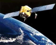
There are a wealth of tools available to government and national security organizations for the purpose of using geospatial analysis. However, these systems are closed to the public. But the average citizen does already has access to huge amounts of global imagery data in the form of familiar web-based applications such as Google Maps. In addition, several private companies, non-profit organizations, and individuals have created tools to provide even better capabilities in an open source environment.
So what is geospatial analysis? Simply put, it is an analytical approach to utilizing geographical data. This data can come in the form of satellite imagery, existing maps, or even geo-located entries into a spreadsheet. Geospatial analysis technology and techniques have broad applications across a number of fields including ecology, national defense, epidemiology, and social sciences – just to name a few.
The list of available open source geospatial analysis tools is daunting. Consisting of software programmed in many different languages and with very different intents, there is likely to be a tool in this list to meet the needs of any person interested in harnessing the power of geospatial data. Organizations like the Open Source Geospatial Foundation have been established in order to better categorize and advance these tools. Their mission is to “support the collaborative development of open source geospatial software, and promote its widespread use.” By connecting the disparate developers of geospatial analysis tools, OSGeo is helping to create an environment of best practices and standards in this open source community.
Several private companies have also contributed to the massive list of geospatial analysis tools. DigitalGlobe is one such firm leading the way in the development of world-wide imagery tools. Using satellite tasking and remote sensing methodologies, this organization provides their diverse range of customers with high fidelity satellite images. Skybox Imaging is another company carrying out this mission to a range of clients. They’ve gone even further, deploying satellites and data centers of their very own.
This brand of geospatial analysis is a great example of how open-source efforts can empower a range of decision-makers with vital information.
Praescient Analytics is a Veteran-Owned Small Business that delivers training, data integration, platform customization, and embedded analytical services in partnership with leading technology providers. Praescient’s teams of analysts and engineers provide comprehensive solutions to federal and commercial clients engaged in critical defense, law enforcement, intelligence, cyber security, financial, investigative, and legal analytics missions.
Charlotte Stasio is Praescient’s Communications Specialist.